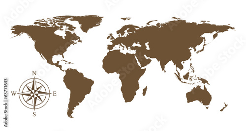
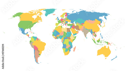
Lustra Na Wymiar World political map. Detailed map of the world with shorelines, national borders and country names. Robinson projection, english labeling, grey illustration on white background.

Zapytaj o produkt
Do ulubionych Autor motywu: ©Peter Hermes Furian id motywu: #2136
Ustaw kadr przesuwając kursor z wciśnietym lewym klawiszem myszki
Wydruk nie będzie posiadał znaku wodnego
Wybierz parametry produktu:
Wybierz układ:
Dodatkowe opcje
x 0,00
Do koszyka


Zobacz także motywy:
 realistic planet earth in space
realistic planet earth in space (#9744)
zmień rozmiar
 Planet earth with sunrise in space
Planet earth with sunrise in space (#9787)
zmień rozmiar
 Sunrise over the Earth in outer space
Sunrise over the Earth in outer space (#9916)
zmień rozmiar
 planeta tierra desde el espacio
planeta tierra desde el espacio (#9731)
zmień rozmiar
 Beautiful space. Elements of this image furnished by NASA
Beautiful space. Elements of this image furnished by NASA (#9743)
zmień rozmiar
 Light on the earth
Light on the earth (#10055)
zmień rozmiar
 The astronauts
The astronauts (#9811)
zmień rozmiar
 The astronaut
The astronaut (#9812)
zmień rozmiar
 Planisphère Mappemonde Vintage - Textes en français. Vecteur CMJN
Planisphère Mappemonde Vintage - Textes en français. Vecteur CMJN (#2137)
zmień rozmiar
 Abstract planet with sun flare in deep space - star nebula again
Abstract planet with sun flare in deep space - star nebula again (#10097)
zmień rozmiar
 The space ship
The space ship (#9967)
zmień rozmiar
 Rising Earth seen from the Moon
Rising Earth seen from the Moon (#9728)
zmień rozmiar
 Weltall - 3D Render
Weltall - 3D Render (#9732)
zmień rozmiar
 Australia road map
Australia road map (#4362)
zmień rozmiar
 Vector world map
Vector world map (#8459)
zmień rozmiar
 Handball background
Handball background (#3611)
zmień rozmiar
 Map Italy
Map Italy (#8478)
zmień rozmiar
 Political map of World
Political map of World (#2085)
zmień rozmiar
 colorful map of the world
colorful map of the world (#2086)
zmień rozmiar
 Colored political World Map and 3D globes with navigation icons
Colored political World Map and 3D globes with navigation icons (#2087)
zmień rozmiar